Posts

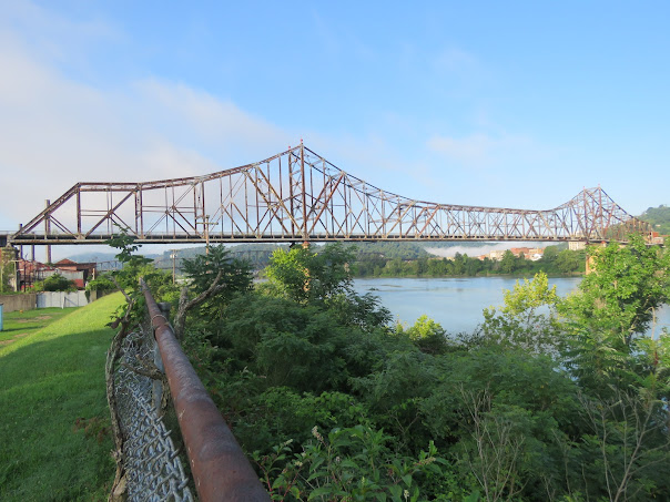
Copper Creek Viaduct, Speers Ferry, VA

Image
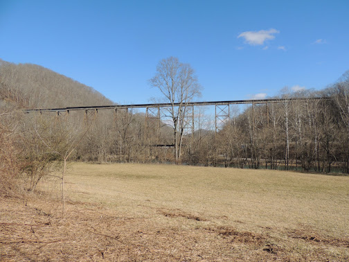
  At the time it was built in 1908, it was the tallest railroad trestle, if not one of the tallest railroad trestles in the eastern United States.  Although it was soon eclipsed by other higher railroad bridges, the Copper Creek Viaduct between Speers Ferry and Clinchport, Virginia has maintained a nostalgic, almost romantic influence on steel truss bridge lovers, this being a popular destination point. Today, generations after the bridge was completed as part of 80 bridges on one of the most ambitious railroad lines in American history, the Copper Creek Viaduct is still one of the most photographed and talked-about steel deck truss bridges in this part of the country. In 1902 when George Carter purchased the Ohio River and Charleston Railroad (earlier known as the 3-C Railroad -- Carolina, Clinchfield and Chicago), his ambitious idea of the railroad he quickly named the South and Western Railway (later the Clinchfield) often placed the railroad bed itself higher than the ground it wou

Bellaire-Benwood Bridge, Bellaire, OH and Benwood, WV

Image
  Standing elegantly over the Ohio River is a huge, heavy-looking , almost 100-year old   bridge that probably should have been gone years ago, but not only is it still here.. it hasn't carried a single vehicle across the river in 32 years! Just south of Wheeling, West Virginia, the Bellaire Bridge (also known as the Bellaire Interstate Toll Bridge and the Benwood Bridge) connects Bellaire, Ohio and Benwood, West Virginia, by way of a steel bridge that's 2,100 feet long.  So why is this beautiful bridge with no vehicles on it still standing?  Traffic was blocked off to the approaches on both sides of the river long ago.  Believe me, many agencies and individuals would love to see this giant mass of steel dynamited right into the swift downwaters of the Ohio River, but so far, the Bellaire Benwood Bridge has defied all the odds. In the 1920's, state governments were looking for ways to get   steady  workers from Ohio to and from the many steel mills that dotted the West Virg

Blevins Bridge, Roan Mountain, TN

Image
  Given the mountainous route, the busiest engine on the legendary Tweetsie Railroad was always called "the little engine that could."  Turns out, at least one of the bridges that ferried that engine and its cargo over the Doe River should have been called "the little bridge that could... have ties to a major steel icon and a worldwide business conglomerate." Industrialist Andrew Carnegie was renowned in the iron and steel manufacturing world in the late 19th century.  As steel mills were expanding from northern cities and establishing factories in the South, Carnegie founded the Keystone Bridge Company in 1865 under his company, the Carnegie Steel Company of Pittsburgh, PA (the Keystone Bridge Company was later absorbed into the American Bridge Company in 1900, still active today as a subsidiary of U.S. Steel). Back in its bridge building heyday, one of Keystone's most notable bridges was the Eads Bridge built in 1874 at St. Louis, Missouri, the oldest bridge s

Old Tugaloo - U.S. 123 Bridge, between Toccoa, GA and Westminster, SC

Image
  The Old Tugaloo River Bridge is a three-span bridge over the Tugaloo River between Toccoa (Stephens County), Georgia and Westminster (Oconee County), South Carolina.  It's also called the Ramsey-Jarrett Bridge, named after local nearby families whose roots date back to the 1800's.    But at first glance, the first question that pops up is.. where's the middle span of the bridge? In any picture of the bridge, you'll see one southern span on the Georgia side of the river, and another northern span on the South Carolina side, but the span right in the middle where the state line should be, is obviously missing. The locals call it the Broken Bridge. A quick history...  The Tugaloo River is the 45-mile long, middle river that forms the border between Georgia and South Carolina.  It connects the Chattooga-Tallulah Rivers upriver, to the Savannah River downstream.  Basically, there has been a bridge crossing around river mile marker 30 since the 1870's, beginning as a si

South Indian Creek, Flag Pond, TN

Image
Only a few people remember when U.S. 23 was just about the only way to get from Kingsport to Asheville, North Carolina. These days, most people zip along Interstate 26 from Tennessee to Carolina over the mountain without ever knowing that the old route on the Tennessee side just downhill from Sams Gap, features a century-old bridge still gallantly standing as a testament to early motor travel between the two states.  This bridge may be the only one left on the old Kingsport to Asheville route that even predates U.S. 23. Coming down the mountain towards Erwin, the Old Asheville Highway made its first crossing over South Indian Creek just north of Flag Pond, Tennessee.  The bridge is an early two-span, one lane, closed-spandrel concrete arch bridge built in 1917. Its two arches are of the parapet style, meaning the railing is actually a continuous part of the bridge deck.  The South Indian Creek Bridge is 75 feet long with the longest span 37 feet in l